Sadales Tikls Monitoring
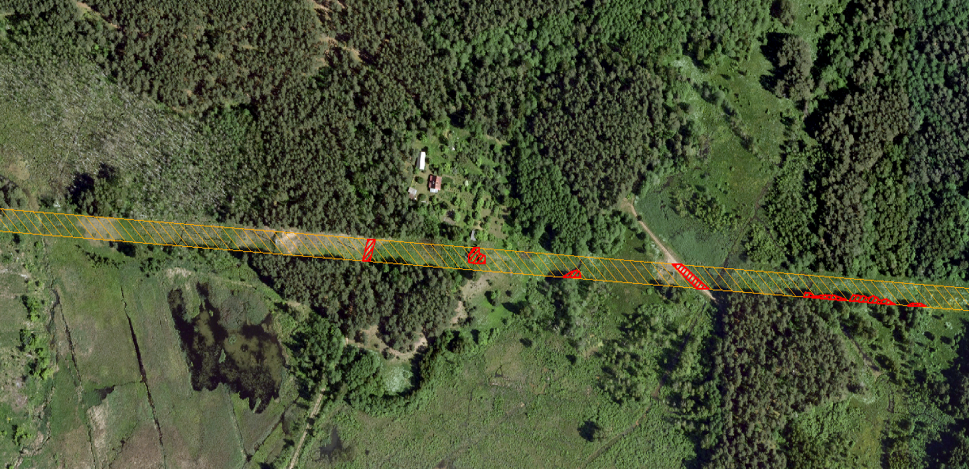
A fully automated vegetation management service for overhead power line infrastructure is being developed through the collaboration of SIA "Baltic Satellite Service" and AS "Sadales tīkls" (ST). This innovative service is designed to significantly enhance the monitoring and management of a vast 60,000-kilometer overhead power line infrastructure by utilizing the latest in satellite imagery technology.
Project Details
Total Investment: €120,000
Additional Funding by Partners: €40,000
Duration: September 2023 to August 2024
Objective: Achieving a Technology Readiness Level (TRL) of 6-8
This service will enable ST to efficiently oversee the distribution network and provide immediate, updated data on various events such as floods, storms, construction, and other event-induced consequences through satellite imagery. This approach will allow for a data-based determination of risk zones, eliminating the need for personnel to visit specific damage or risk sites physically.
Key Benefits:
Risk Zone Mapping: Data-based determination of risk zones using satellite images, reducing the need for physical inspections.
Infrastructure Safety: Enhanced controlled safety of the surface power grid infrastructure, ensuring a secure supply of electricity.
Maintenance Optimization: Identification of priority areas for track cleaning and quality control of work performance, optimizing maintenance operations.
Disaster Resilience: Development of a more climate-resistant network capable of quick responses to natural disasters such as windstorms, snowstorms, and floods.
Data-Informed Decisions: Constant availability of the most current field data to ST, allowing for informed decision-making and timely interventions.